CONFESS General Assembly

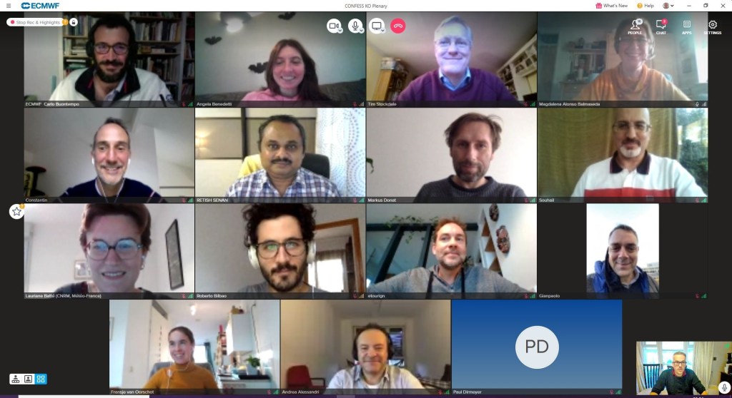
CONFESS hosted its first public General Assembly online on the Wednesday, 1st December 2021 from 09:00 UK Time.

Over 70 participants from Europe and beyond heard about the objectives and progress of the project.

Presentations from the meeting are available below.

9:00 – 9:40 Welcome and Introduction to the GA

TimePresenterPresentation
9:00-9:10Jean-Noel Thepaut (Director of Copernicus department at ECMWF)Welcome 
9:00-9:20Magdalena A. Balmaseda (Project Leader)Introduction to the GA and practicalities

9:20-10:20 CONFESS in the Copernicus Context

TimePresenterPresentation
9:20-9:50Hans Hersbach (ECMWF, invited)C3S Earth System Reanalyses: progress and planned evolution
9:50-10:20Antje Innes (ECMWF, invited)Updates to CAMS reanalyses activities and synergies with climate

10:30 – 12:00 WP1: Continental Surfaces Impact (soil & vegetation, land-use)

TimePresenterPresentation
10:30-10:45Constantin Ardilouze (Meteo France)Overview of progress in WP1
10:45-11:00Souhail Boussetta (ECMWF)Task 1.1 Harmonization of Copernicus observational records with focus on vegetation
11:00-11:15Andrea Alessandri (CNR)Task 1.2. Implementation in HTESSEL/SURFEX to assess interannual variability
11:15-11:30Gildas Dayon (MeteoFrance)Task 1.3: Sensitivity of land surface conditions to dynamic vegetation
11:30-11:40Andrea Alessandri (CNR)Outreach and dissemination. Links to other international projects
11:40-12:00Questions and discussion

13:00 – 14:15 WP2  Aerosols in Troposphere and Stratosphere

TimePresenterPresentation
13:00-13:15Roberto Bilbao (BSC)Overview of Progress in WP2
13:15-13:30Tim Stockdale (ECMWF)Task 2.1 Harmonization of CMIP6 and C3S/CAMS data with IFS (decadal variations)
13:30-13:45Angela Benedetti (ECMWF)Task 2.2. Capability to react to hazardous events: Biomass burning.  PART A: Experimental set up and Biomass Climatology
13:45-14:00Etienne Tourigny (BSC)Task 2.2 Capability to react to hazardous events: Biomass burning. PART B:  Empirical model for biomass burning emissions
14:00-14:15Tim Stockdale (ECMWF)Task 2.3 Capability to react to volcanic eruptions events
14:15-14:30Questions/Discussion 
14:30-15:00Joao Teixeira (UK MetOffice, Invited)Coupling fire with vegetation  in the UK MetOffice Earth System Model
15:15-15:45Julia Green (University of Berkeley, Invited)Regional atmosphere-terrestrial biosphere feedbacks

15:45-16:15 WP3 Integration and testing in initialised forecast and multi-year integration and Final Discussion

TimePresenterPresentation
15:45-16:00Lauriane Batte (Meteo France)Overview and progress: Experimental protocol
16:00-16:15Final discussion 
16:15Closure

Year 1 highlights

The first period of the CONFESS project running from 1 November 2020 to 31 October 2021 has just concluded, and an impressive list of results has been achieved.

WP1

  • A harmonized observational Leaf Area Index (LAI) dataset covering the 1993-2019 period has been finalized and disseminated to CONFESS partners.
  • The Land Use / Land Cover (LULC) dataset has been adapted to IFS Vegetation Types and shared with partners
  • The FCover dataset has been retrieved and finalized to support modelling in task 1.2 and 1.3.
  • Annual maps of LULC derived from LUH2 have been produced consistently with SURFEX plant functional types
  • Vegetation and atmospheric input (ERA5 hourly forcing) have been prepared separately for each partner.
  • A list of land model output (variables, frequency) has been agreed and shared between partners.
  • Spin-up of Land-only simulations with prescribed LAI is about to be run.
  • Performed parameter estimation and optimization for the implementation of the effective vegetation-cover parameterization based on FCover and LAI data: the observational data of FCover was retrieved for the time period 1999-2019 and harmonized using a CDF matching approach consistent with what was done  by ECMWF for the LAI data .
  • The observational FCover and LAI data have been first categorized by land cover type as identified in the observational ESA CCI land cover dataset on a 9km (Tco1279) grid.
  • Performed a historical land-only simulation with interactive vegetation.

WP2

  • A new approach has been developed to derive a new version of the CAMS aerosol climatology, using the latest IFS version with full chemistry and aerosol, and including 14 aerosol types.
  • A new climatology will be derived over a multi-decadal period to allow the creation of a time-varying climatology, to obtain both a more accurate representation of the present -day climatology, and a much more accurate representation of the time-evolution at a regional scale.
  • A test-suite for this new approach has been successfully implemented.
  • A climatology was created from the Global Fire Assimilation System (GFAS) developed and maintained by CAMS, which is due to be made available in the Atmosphere Data Store.
  • Observed emissions from GFAS are already implemented in the IFS ENS which will be used to carry out the experiments.
  • The modelling first on FireCCI burned area at 0.25 deg resolution aggregated over 12 months periods centered around the peak month (for each grid point) has started.

WP3

  • The experimental protocol for the experiments in WP3 has been developed, covering all the experiments in the WP (Tasks 1, 2 and 3).
  • Production of re-forecasts with prescribed changes in land surface conditions will start in the second year of the project.

Vegetation dataset of Land Use/Land Cover and Leaf Area Index

A new deliverable provides the land use land cover data based on the ESA-CCI/C3S, and the Leaf Area Index data for the period of 1993 to 2019, based on harmonization of the CGLS/C3S data and the AVHRR based data. These data will be prescribed into the offline and coupled model to assess the impact of their inter-annual variability on reanalysis and seasonal forecast.

The Vegetation dataset of land use/land cover (LU/LC) and Leaf Area index (LAI) are essential for the CONFESS project. One of the main targets of this project is improving the usability of the information delivered across different Copernicus Services within the land-atmosphere coupled system. It aims at using new Earth Observations of LU/LC and vegetation states and the impact of their inter-annual variability on reanalysis and seasonal forecast.

CONFESS uses the LU/LC and LAI data from the Copernicus Climate Change Service (C3S) and the Copernicus Global Land Services (CGLS) for the period from 1993 to 2019. The LU/LC data is provided at a yearly frequency and adapted to the BATS classification as used within the ECMWF Integrated Forecasting System (IFS). The LAI data provided every 10-days, is extended from the 1999 to 1993 with the AVHRR-based data available through the C3S and interpolated to 1km spatial resolution. The harmonisation of the LAI data from the two data sources is assured with a CDF matching procedure.

You can read more about the datasets in D1.1 Vegetation dataset of Land Use/Land Cover and Leaf Area Index.

CONFESS – 9 months in

CONFESS has completed its first nine months of its planned activities, resulting in 7 deliverables, of which 8 are publicly available.

CONFESS partners are busy preparing first data sets in the form of harmonized CAMS and CMIP6 datasets for aerosols that are due to be published in October 2021.

Regular meetings are taking place both within the consortium as well as with stakeholders from the Copernicus Climate Change Service to ensure the results of the project will add value,

If you want to learn more about the project, please do not hesitate to contact us.

Experimental protocol for land and aerosol forcing re-forecasts

A new document has been published that provides a description of the re-forecasts planned in WP3 to assess the impact of improved boundary forcings in an initialized climate prediction setting.

Several sets of experiments are planned. A first category of experiments relate to developments in WP1 on the representation of time-varying land use and vegetation in land surface models and reanalyses, which are key ingredients for seasonal forecasting systems and multi-annual forecasting systems operated in the framework of the Copernicus Climate Change Service (C3S). Another category of experiments will evaluate the impact of tropospheric and volcanic aerosol forcing on seasonal and multi-annual experiments.

This document details plans for each model / system as of Month 9 of the project. In some cases, which are specified, some details of the experimental setup are yet to be decided based on results from analyses in WP1 and WP2. However, this deliverable provides a first framework for WP3 activities and leaves room for future adjustments, to be agreed among partners, when needed.

You can read more about the protocol in D3.1 Experimental protocol for land and aerosol forcing re-forecasts.

CONFESS Data Management Plan

The CONFESS Data Management Plan responds to the requirements of the H2020 Open Research Data Pilot to document which research data is being produced by the CONFESS project, in which format, and how it will be made available. It has already identified data sets for work packages 1 to 3, but is only to be seen as an initial version which requires periodic updates to provide the necessary detail as it emerges.

The data management plan, available here, provides details for the following data sets:

  • Leaf Area Index (LAI)
  • Land Surface Model Simulations
  • Land Cover
  • Land Use Harmonisation (LUH2)
  • Fraction of Vegetation Cover (FCover)
  • Harmonised CMIP6/CAMS time-varying climatology of tropospheric aerosols
  • Seasonal re-forecasts
  • Multi-year integrations

If you would like to know more about the data sets that will be made available, please contact us.

Planned results

CONFESS is an ambitious project with equally ambitious outcomes. CONFESS will produce:

Data sets

  • Mapping of harmonized multi-year records of vegetation (LAI) and land cover ready for ingestion by the CHTESSEL and SURFEX models, suitable for their use in reanalyses and seasonal forecasts. This should improve the temporal variations of land properties, with expected impacts on regional climate and hydrology.
  • A harmonized multi-year data record of tropospheric aerosol by merging CMIP6 and CAMS information. This should result in an improved and more accurate representation of the time variation of tropospheric sulphate aerosols, available for use in future reanalyses and seasonal forecasts, with potential for improving global trends and low frequency large scale climate variability. It will be the first attempt to create a seamless temporal record of tropospheric aerosols suitable for a range of applications: reanalysis, seasonal forecasts, near-term predictions and multi-year climate integrations.

Model capabilities

  • Improved parameterizations that allow for consistent time varying properties of land cover and vegetation, in CHTESSEL and SURFEX;
  • Vegetation models in CHTESSEL and SURFEX validated according to their impact on climate;
  • A more accurate representation of observed volcanic aerosol, built into the IFS and available for use in future reanalyses and seasonal re-forecasts. This should result in better representation of large scale low frequency variability, and reduction on the uncertainty of natural versus forced climate variability;
  • A low-cost predictive model for the evolution of volcanic aerosol after a major eruption, which produces data in an easy-to-use form for seasonal prediction models. This provides a capability for such systems to react to major volcanic eruptions;
  • A single-species aerosol model for biomass burning forced by prescribed fire emissions embedded in seasonal forecasting systems. This will enable seasonal forecasting systems to attribute impact of large biomass burning events on regional climate, and will prepare the ground for future C3S evolution.

Proof of concepts and prototypes for C3S

  • Prototype of a land reanalysis representing consistent temporal variations of land cover and vegetation for the period 1993-present.
  • Proof-of-concept for treatment of temporal variations of land properties -land cover and vegetation- and improved radiative forcing from tropospheric aerosols in a full reanalysis.
  • Prototype of next generation of seasonal forecasts with treatment of temporal variations of land properties -land cover and vegetation- and improved radiative forcing from tropospheric aerosols.
  • Prototype of volcanic aerosols prediction module interfaced with seasonal forecast. New capability for C3S.
  • Proof-of-concept module for biomass burning impact interfaced with seasonal forecasts. New capability for C3S.

Knowledge

  • Scientific validation of developments on land cover and vegetation variations.
  • Scientific validation of improvements in tropospheric and stratospheric aerosols.
  • Assessment of land and aerosol improvements on seasonal forecast skill, global trends and representation of regional extremes
  • Recommendations for implementation in the C3S systems

CONFESS Project Kicked Off

The CONFESS project has officially started on the 1st of November 2020. Led by the European Centre for Medium-Range Weather Forecasts and with Partners Meteo-France, Barcelona Supercomputing Centre and the Italian National Research Council, the project will run for 36 months with the aim to  improve the reliability and usability of Copernicus Climate Change Service information in the land-atmosphere coupled system by exploiting new and improved Earth Observations data records of land-use, vegetation states and surface-emitted aerosols delivered across different Copernicus Services.

The project had its virtual Kick-off meeting on the 3rd and 4th of November, bringing together both members of the consortium as well as stakeholders and advisers. The meeting focused on planning the work for the first year of the project.

CONFESS Kick-off Meeting